Real estate marketing has undergone a dramatic transformation over the past decade. What once relied on flattering angles and wide-angle static photographs has evolved into fully immersive 3D experiences that allow clients to walk through spaces digitally before ever stepping foot inside. For architects, interior designers, and renovation professionals, this shift represents something far more significant than a marketing upgrade—it opens the door to exceptionally accurate digital replicas of physical spaces that serve as the foundation for planning, design, and client communication.
The challenge, however, lies in precision. Architects don’t simply need attractive visuals; they require measurable, dimensionally accurate 3D models that can inform structural decisions and renovation plans. Today’s “real estate photography lens” has expanded well beyond a single camera optic. It now encompasses an integrated suite of technologies—LiDAR depth sensing, comprehensive 3D scanning, and advanced HDR imaging—working in concert to capture spatial reality with remarkable fidelity. Together, these tools are revolutionizing how professionals create digital twins of existing structures, dramatically improving both precision and workflow efficiency in architectural visualization.
Beyond the Camera: The New Toolkit for Architectural Visualization
Traditional real estate photography aimed to make spaces look appealing—wide-angle lenses stretched rooms, careful staging drew the eye, and post-processing polished every frame. But architects and design professionals need something fundamentally different. They need actionable spatial data: precise measurements, accurate geometries, and reliable surface information that can drive real-world decisions about structural modifications, material specifications, and spatial planning.
This requirement has redefined what a “lens” means in the context of architectural documentation. The modern toolkit combines three complementary technologies, each addressing a distinct dimension of spatial capture. LiDAR provides depth—measuring distances between surfaces with laser precision to establish the exact volumetric boundaries of a space. Three-dimensional scanning captures geometry, recording the complex shapes of architectural elements including moldings, irregular surfaces, and structural features that defy simple measurement. HDR imaging contributes lighting and textural truth, preserving surface detail across extreme brightness ranges so that materials read accurately in the final model. When these three technologies converge on a single space, the result transcends photography entirely. What emerges is a comprehensive digital twin—a dimensionally faithful, visually rich replica that architects can measure, section, annotate, and build upon with confidence that their digital reference matches physical reality.
LiDAR Scanner and 3D Scanning: Capturing Spatial Reality
LiDAR—Light Detection and Ranging—works by emitting thousands of laser pulses per second, measuring the time each pulse takes to bounce off a surface and return to the sensor. This simple principle, scaled to millions of measurements, produces an extraordinarily detailed spatial map of any environment. The technology now appears in two distinct forms relevant to architectural documentation: consumer-grade sensors embedded in devices like the iPad Pro and iPhone Pro, and dedicated professional scanners from manufacturers such as Leica, Faro, and Matterport that deliver substantially higher point density and range accuracy.
The output of a LiDAR scan is a point cloud—a three-dimensional constellation of measured coordinates that collectively describe every visible surface in a space. Each point carries precise positional data, and when millions of these points accumulate, they reveal the exact geometry of walls, ceilings, structural columns, and architectural details with millimeter-level accuracy. This stands in contrast to photogrammetry-based 3D scanning, which reconstructs geometry by triangulating visual features across overlapping photographs. While photogrammetry excels at capturing surface texture and works well for exterior facades, it struggles with featureless surfaces like white walls and reflective materials—exactly the conditions found in many interior spaces where LiDAR performs reliably.
For architects, the practical advantages are substantial. Complex spaces that would require hours of manual measurement—rooms with irregular geometries, vaulted ceilings, or intricate millwork—can be captured in minutes. A single scan session replaces tape measures, laser distance meters, and the inevitable return visits when a critical dimension was missed. The technology captures what the human eye notices and what it overlooks equally, creating a complete spatial record that remains available for reference throughout the entire project lifecycle.
From Points to Model: The Power of Point Cloud Technology
The raw point cloud, while dimensionally accurate, is not yet a usable architectural model. It exists as an unstructured collection of spatial coordinates—dense, information-rich, but lacking the defined surfaces, edges, and object classifications that design software requires. Transforming this data into actionable documentation involves several critical processing steps.
First, the raw scan data undergoes registration and alignment. When multiple scan positions are needed to capture a complete space—which is typical for anything beyond a single room—software algorithms stitch overlapping point clouds together using shared reference points, creating one unified spatial dataset. Next comes cleaning: removing noise from reflective surfaces, eliminating stray points caused by moving objects during the scan, and filtering redundant data to produce a manageable file size without sacrificing geometric accuracy.
The processed point cloud then imports directly into CAD and BIM platforms such as Autodesk Revit, ArchiCAD, or Vectorworks, where it serves as a dimensionally precise underlay. Architects trace over the point cloud to generate vector-based floor plans, sections, and elevations—knowing that every line they draw corresponds to a verified physical measurement rather than an assumption. This workflow represents the critical bridge between raw spatial capture and high-precision 3D models suitable for construction documentation, enabling renovation projects to proceed from a foundation of verified existing conditions rather than approximations that compound errors downstream.
HDR Imaging: The Essential Companion for Textural Fidelity
A dimensionally perfect 3D model stripped of realistic surface appearance is like an architectural blueprint without material callouts—geometrically correct but visually incomplete. LiDAR and structured-light scanners excel at capturing shape, but they typically record limited color information, often producing flat, washed-out textures that fail to convey the true character of materials. Polished marble reads the same as painted drywall; aged brick becomes indistinguishable from smooth concrete. For architects conducting material assessments or preparing client-facing presentations, this deficiency undermines the model’s practical value.
HDR imaging solves this problem by capturing the full luminance range of a scene through multiple bracketed exposures—typically three to nine frames spanning deep shadows to bright highlights—then merging them into a single image containing far more tonal information than any individual photograph. This technique preserves subtle grain in dark wood paneling, reveals texture in sunlit stone surfaces, and maintains readable detail in recessed areas where standard exposures would clip to black. When these HDR-captured textures are projected onto the scan’s geometric mesh through a process called texture mapping, the result is a photorealistic 3D model where every surface reads truthfully. Architects can assess existing finishes remotely, designers can study how natural light interacts with materials throughout the day, and clients can experience proposed renovations within a context that genuinely represents the existing space’s visual character—bridging the gap between raw spatial data and compelling, trustworthy visualization.
A Practical Guide: Integrating These Tools into an Architect’s Workflow
Understanding the technology is one thing; deploying it efficiently on real projects is another. Many firms recognize the value of high-precision 3D capture but struggle with implementation—uncertain about sequencing, overwhelmed by software options, or unsure how to bridge the gap between raw scan data and deliverable documentation. The following workflow breaks the process into three manageable phases that any architectural practice can adapt to their specific project requirements and equipment budget.
Step 1: Pre-Scan Planning and On-Site Capture
Successful spatial capture begins before the scanner powers on. Walk the site first to identify scan positions that ensure complete coverage with minimal overlap gaps—typically placing stations at doorways, room centers, and corridor intersections so that every surface falls within range of at least one position. For quick existing-condition surveys or early feasibility studies, a mobile LiDAR scanner such as the iPad Pro offers remarkable convenience, capturing room geometries in minutes with accuracy sufficient for preliminary planning. When the project demands construction-grade precision—detailed renovation documentation, heritage conservation, or complex structural assessments—a dedicated scanner delivers the point density and range accuracy the work requires. During the same site visit, capture HDR bracketed photographs of every surface using a tripod-mounted camera set to auto-bracket three to seven exposures. Shoot systematically, ensuring each wall, floor, and ceiling receives coverage under consistent conditions. This parallel capture approach eliminates return visits and guarantees that texture data aligns temporally with the geometric scan.
Step 2: Data Processing and Model Generation
Back in the office, processing software handles the heavy computational work of transforming raw captures into usable models. Platforms like Leica Cyclone, Autodesk ReCap, or RealityCapture import individual scan stations and align them using overlapping geometry, producing a single unified point cloud that represents the entire captured space. This registration step demands attention—verify alignment accuracy at overlap zones and manually correct any drift before proceeding. Next, clean the dataset by removing noise artifacts from mirrors, glass, and reflective surfaces, and delete points generated by objects that moved during scanning such as curtains or occupants. The software then generates a triangulated mesh from the cleaned point cloud, creating continuous surfaces from discrete points. Finally, project the HDR photographs onto this mesh through texture mapping, producing a photorealistic 3D model where geometric precision and visual fidelity coexist in a single deliverable.
Step 3: Integration into Design and Presentation
The processed model now enters the design environment where it drives real project decisions. Import the point cloud or mesh directly into BIM platforms like Revit or ArchiCAD, where it functions as a dimensionally verified underlay for modeling existing conditions. Architects trace walls, floors, and structural elements over the scan data to produce accurate as-built drawings without the uncertainty inherent in manual field measurements. For renovation planning, the model reveals spatial conflicts, clearance constraints, and structural relationships that might otherwise surface only during construction. Beyond technical documentation, the textured 3D model serves as a powerful communication tool—generate fly-through animations for client presentations, create sectional perspectives that reveal proposed interventions within their existing context, or export to virtual reality platforms where stakeholders can experience design proposals at full scale before any physical work begins.
Choosing the Right “Lens”: Equipment and Software Considerations
Selecting the appropriate capture equipment depends on the precision demands of your typical projects and the resources available to your practice. Professional-grade 3D scanners from manufacturers like Leica and Faro deliver sub-millimeter accuracy and dense point clouds capable of documenting the most demanding heritage conservation or complex renovation work—but they require significant investment and trained operators. Consumer-grade LiDAR, now embedded in tablets and smartphones, offers a compelling entry point for firms handling routine residential surveys, feasibility studies, or projects where centimeter-level accuracy suffices. The gap between these tiers continues to narrow, but for construction documentation where tolerances matter, dedicated hardware remains the professional standard.
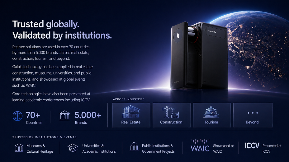
For HDR texture capture, a full-frame or crop-sensor mirrorless camera with automatic exposure bracketing capability provides the dynamic range needed to faithfully record interior surfaces. Pair it with a sturdy tripod and a moderate wide-angle lens that minimizes barrel distortion—something in the 24-35mm equivalent range strikes the right balance between coverage and geometric accuracy. On the software side, processing pipelines vary by budget and complexity. Autodesk ReCap and Leica Cyclone handle point cloud registration and cleanup for professional scanners, while RealityCapture and Metashape bridge photogrammetry and mesh generation workflows. PropTech platforms such as Realsee have also emerged to streamline the end-to-end process of creating immersive 3D virtual tours from scan data, making digital twin technology more accessible to practices of varying sizes. For BIM integration, Revit and ArchiCAD both accept point cloud imports natively. Smaller firms might start with a mobile LiDAR device and free or low-cost processing tools, scaling to dedicated hardware as project demands and revenue justify the investment—building capability incrementally rather than committing to the full ecosystem at once.
The Future of Integrated Spatial Capture in Architectural Practice
The modern real estate photography lens has evolved far beyond any single optic or camera body. It now represents a convergence of LiDAR depth sensing, comprehensive 3D scanning, and HDR imaging—three technologies that, working together, produce digital twins of extraordinary precision and visual authenticity. This fusion directly addresses what architects and design professionals have always needed but rarely achieved through traditional methods: measurable, dimensionally accurate 3D models that serve as reliable foundations for renovation planning, structural assessment, and design development.
The workflow implications are equally transformative. What once required multiple site visits, hours of manual measurement, and inevitable gaps in documentation now consolidates into a streamlined capture-process-integrate pipeline that delivers verified existing conditions faster and more completely than any previous methodology. Architects spend less time gathering data and more time designing with confidence that their digital reference faithfully represents physical reality. As these technologies continue to mature—with consumer-grade devices approaching professional accuracy and processing software becoming increasingly automated—mastering this integrated approach is no longer a competitive advantage reserved for large firms. It is becoming a baseline expectation for any practice committed to efficiency, accuracy, and compelling client communication in an industry that increasingly demands digital fluency as the standard of professional practice.

Art Prompt Generator: Ignite Your Creative Spark

BarAPK Org: Your Go-To Platform for Secure APK Downloads
Measuring Investment Progress: Practical Ways to Use Return Projections